
中文
City-scale 3DGS Full-stack Solution


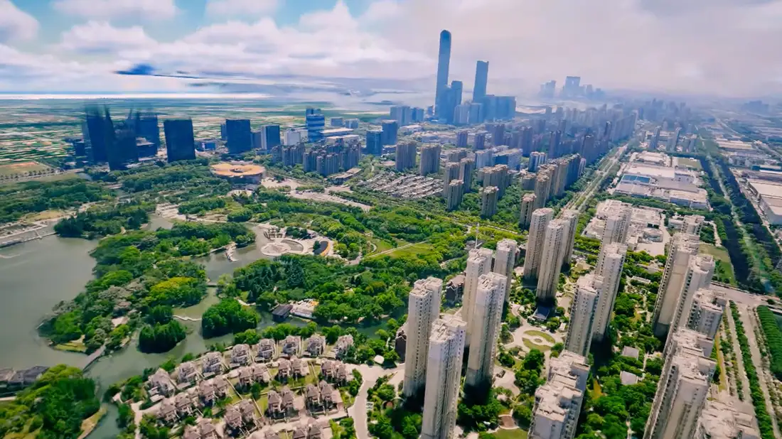
The solution covers the full pipeline from intelligent route planning → automated multi-GPU cluster modeling → high-performance web rendering and application development.

It supports 3D reconstruction of up to 100 km², with modeling efficiency as high as 1 hour/km². It also fuses and renders 3DGS models with traditional oblique photography models and vector base maps, and provides diverse application capabilities such as POI object management and spatial measurement — delivering a standardized 3D foundation for digital twins, smart cities and emergency disaster assessment.

Supportarrow
Solution Video
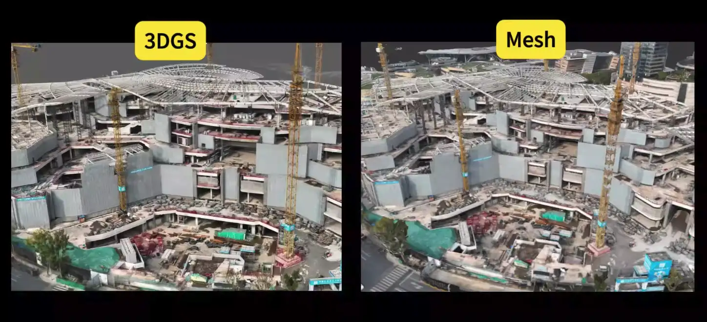
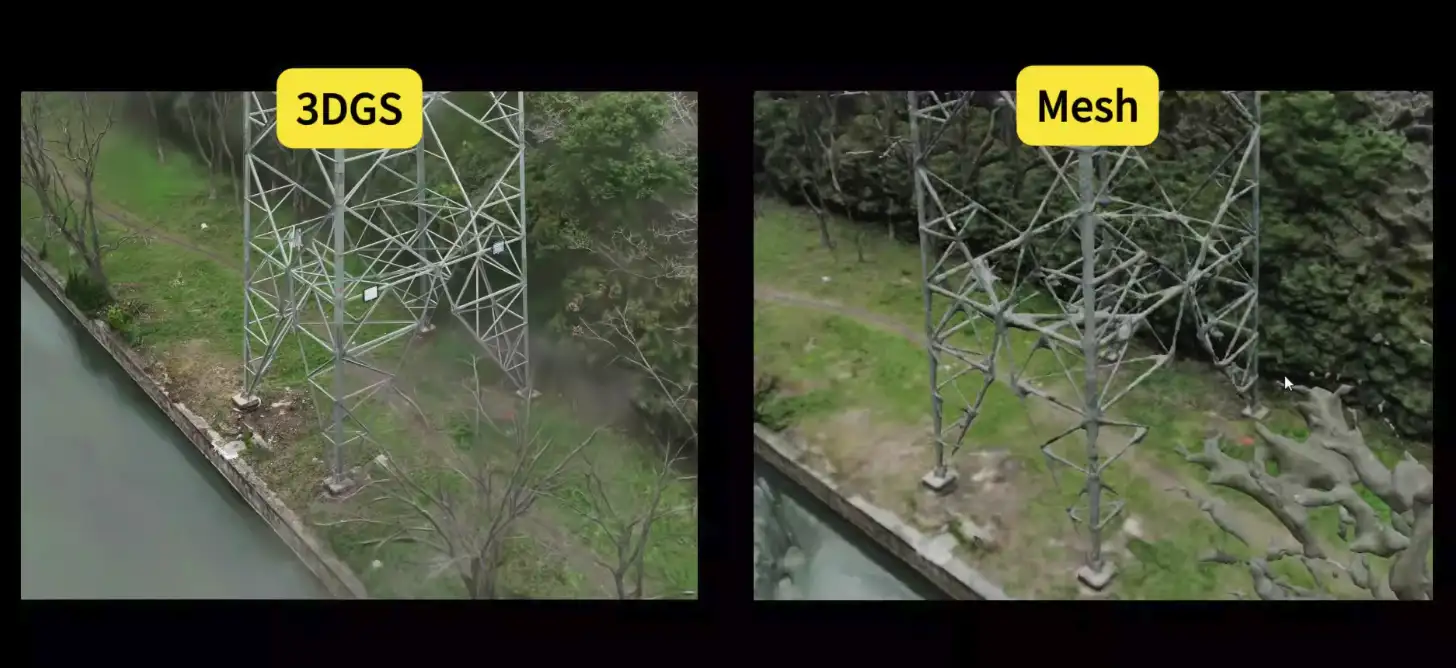
3DGS VS Oblique Photography
3D Gaussian Splatting
VS
Oblique Photography (Traditional)
Real-time visualization preview, efficient and intuitive, with minute-level rapid modeling
Efficiency
No real-time feedback on modeling progress; time-consuming, same scene takes hours to model

Visual quality close to real photos, high-frequency details fully preserved — fine structures like building ornaments and vegetation restored at >90%
Detail Preservation
Insufficient visual detail — fine structures like building ornaments and vegetation retained at <50%, with cracks and blur, weaker realism
Compact data size saves storage and transmission; only 10% of oblique models for the same scene
Storage & Transmission
Large data size hampers efficient transmission and cloud deployment; 10× the data of 3DGS for the same scene
Supports multi-temporal scene simulation, rendering monthly or yearly real-scene changes in continuous animation
Dynamic Scenes
Hard to show multi-temporal scene changes; layer-switches between models from different times
Construction-site 3DGS vs Oblique Model
Play Video
Power-tower 3DGS vs Oblique Model
Play Video
Mapmost Technical Advantages & Features
Geospatialization
Geographic coordinate restoration
Real-geographic-coordinate 3DGS modeling from RTK imagery, ensuring accurate geographic positions for 3DGS models;
3D spatial measurement
Surface point selection and 3D spatial measurement on 3DGS models;
Large-area Modeling (100 km²)
GIS multi-source fusion application development
Web 3D map engine: the Mapmost SDK for WebGL provides a 3DGS-supporting map application SDK for digital-twin city scenarios.
Trial: Mapmost SDK for WebGL
Large-area Modeling (100 km²)
LOD modeling & web real-time rendering
Supports city-scale 3DGS reconstruction beyond 100 km², with multi-level LOD modeling, 3D geospatial indexing and 3DGS tiling. Combined with the Mapmost SDK for WebGL, it loads and renders massive models smoothly on the web in real time;
Large-area Modeling (100 km²)
Air-ground fusion modeling

Fuses UAV aerial imagery with handheld ground scanner data for 3DGS modeling, resolving blur caused by incomplete single-device coverage;
Large-area Modeling (100 km²)
Detail restoration from UAV views

Improves 3DGS algorithms to capture high-frequency detail, raising visual quality by 10% and markedly improving modeling of roofs, grass, road lines, windows and other fine-texture areas;
Large-area Modeling (100 km²)
Multi-GPU high-performance modeling
Distributed parallel modeling: with 4× RTX4090, UAV-collected city scenes are modeled at up to 1 h/km². A “fast mode” builds 1 km² in 20 minutes to meet real-time emergency-response modeling needs;
Large-area Modeling (100 km²)
GIS multi-source fusion application development
Web 3D map engine: the Mapmost SDK for WebGL provides a 3DGS-supporting map application SDK for digital-twin city scenarios.
Trial: Mapmost SDK for WebGL
Large-area Modeling (100 km²)
LOD modeling & web real-time rendering
Supports city-scale 3DGS reconstruction beyond 100 km², with multi-level LOD modeling, 3D geospatial indexing and 3DGS tiling. Combined with the Mapmost SDK for WebGL, it loads and renders massive models smoothly on the web in real time;
Mapmost 3DGS VS Native 3DGS
Mapmost 3DGS
VS
Native 3DGS
Built-in geographic coordinates, supports 3D spatial measurement
Geospatialization
No geographic coordinates, no spatial measurement
Ultra-large coverage, supports 100 km² city-scale modeling
Coverage
Small coverage, max 2 km² modeling
Full-view coverage, supports collaborative modeling with UAV and ground devices
Air-Ground Fusion
Incomplete views, only single-device capture modeling
High-fidelity detail, algorithms optimized for UAV modeling, visual quality up 10%
Model Quality
Weak detail restoration; UAV modeling struggles with building-part and vegetation textures
Multi-GPU high-performance modeling, city modeling at ~1h/km² (RTX 4090 ×2)
Modeling Efficiency
No multi-GPU high-performance modeling, city modeling at ~5h/km²
Supports GIS multi-source data fusion for digital-twin scenes, 400+ secondary-development APIs
App Development
No fusion with 3D maps, oblique, hand-crafted models, BIM and other multi-source data for app scenarios
3DGS Full-chain Tools: Capture – Model – Develop
3DGS UAV Collection Route Planning Software

For 3DGS data collection, it fuses multiple flight modes and supports “aerial parameter setting”, “3D collection route generation” and “route/waypoint export”, with export files directly usable for DJI UAV operations.
3DGS Multi-GPU High-performance Modeling Tool


Supports multi-GPU resource allocation and one-click automation of “aerial triangulation”, “intelligent partition training”, “LOD hierarchical modeling” and “3DGS tiling” — building high-quality city-scale 100-km² 3DGS scenes without manual intervention.
3DGS LOD Service Publishing
Supports publishing LOD 3DGS results as tile services via static-resource tools such as Anywhere or Nginx, loaded and rendered at city scale through the Mapmost SDK for WebGL.
Mapmost SDK for WebGL Development Kit

Supports fusion loading and rendering of 3DGS models across 100+ km² with multi-source geographic data, offering 400+ APIs for digital-twin application development.
SDK download & tutorial
The Industry's First 3DGS Development Kit Fused with Geographic Scenes
Mapmost SDK for WebGL is a lightweight digital-twin development tool (JavaScript library) offering developers 400+ APIs across 7 categories — data, services, interaction, models, visualization, effects and analysis — with multi-source data fusion, visual expression, computing and analysis capabilities. It loads vector tile map services, 3DGS (Gaussian Splatting) models, oblique 3D models, gltf/glb 3D models, obj 3D models, and WMS, TMS and WMTS map services.
Multi-source Data Fusion Visualization

Supports fusion loading and visualization of 3DGS models with multiple 2D/3D geospatial data — oblique 3D, 2.5D vector maps, 3D manual models and satellite imagery.
3DGS & POI Object Management
Builds real-scene 3D geographic scenes with 3DGS and places POIs to present business attributes of entities — for managing geographic entities or location objects.
3D Spatial Measurement
Supports length and area measurement in 3D space using 3DGS as the base map.
3D Scene Applications
Supports developing dynamic/static graphic elements in 3DGS scenes for data analysis or business flows — heatmaps (2D, 3D), geofences, trajectory animation, visual effects (flame, effect spheres) and perspective flight.
Apply for Modeling Tool Trial / Product Consultation
Please email: sales@mapmost.com
Phone
Email