Surface excavation analysis
Supports surface excavation of vector and raster data, and can set the excavation depth and excavation part map.
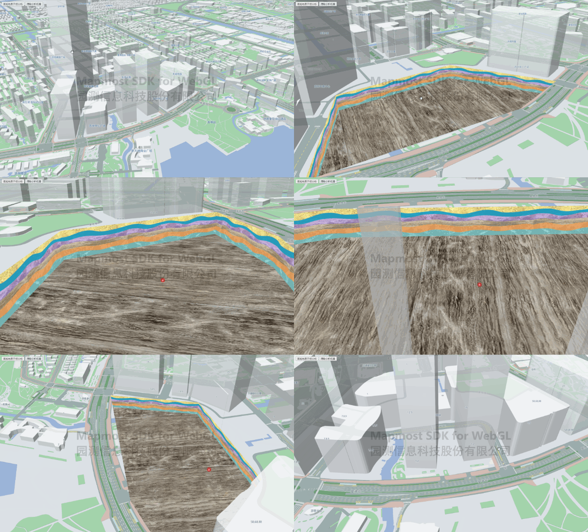
   <!DOCTYPE html>
   <html>
   <head>
       <meta charset="utf-8"/>
       <title>Surface excavation analysis</title>
       <meta name="viewport" content="initial-scale=1,maximum-scale=1,user-scalable=no"/>
       <style>
           body {
               margin: 0;
               padding: 0;
           }

           #map {
               position: absolute;
               top: 0;
               bottom: 0;
               width: 100%;
           }

           .btn-group {
                position: absolute;
                top: 20px;
                left: 20px;
                color: white;
           }
       </style>
       <script src="https://delivery.mapmost.com/cdn/sdk/webgl/v9.16.0/mapmost-webgl-min.js"></script>
   </head>
   <body>
   <div id="map"></div>
    <div class="btn-group">
      <button onClick="add()">Add surface excavation analysis</button>
      <button onClick="clear()">Clear analysis results</button>
    </div>
    <script>
      let map = new mapmost.Map({
        container: "map",
        style: "<your style url>",
        center: [120.67287475351259, 31.320097198762696],
        zoom: 16,
        pitch: 62,
        userId:"***", //Authorization code
      });

      let excavation;

      //Add excavation analysis
      function add() {
        excavation = new mapmost.ExcavationAnalysis(map);
        excavation.analyse({
          range: [
            [120.67315864678835, 31.317114830759607],
            [120.67250888359933, 31.31987574694101],
            [120.67458298302142, 31.32163926950146],
            [120.6753580544011,  31.32017624607974],
            [120.67581891774245, 31.316551049511048],
            [120.67315864678835, 31.317114830759607],
          ], //Set the excavation range
          depth: 40, //Set the excavation depth
          sideImg: "./excavationAnalysis/excavate_kuangqu.jpg", // Set the excavation side texture
          bottomImg: "./excavationAnalysis/excavate_bottom.jpg", // Set the excavation bottom texture
        });
      }

      //Clear the analysis results, retain the analysis instance, and update the analysis results
      function clear() {
        excavation.clear();
      }

   </script>
   </body>
   </html>