



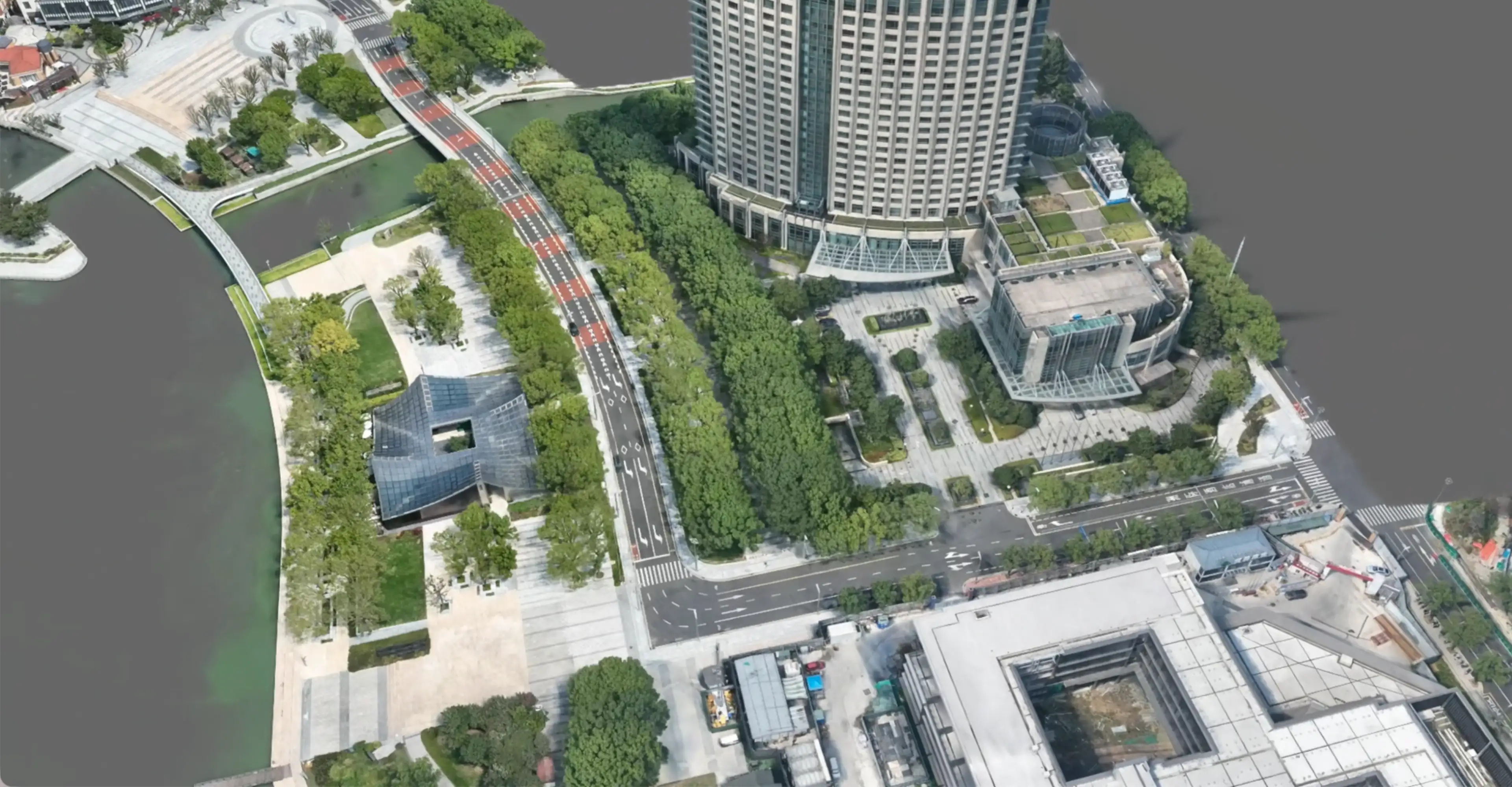
Product List
Mapmost 3DGS Builder
Professional 3D Gaussian Reconstruction Platform
Turn your photos into real 3D models in just 30 minutes
- Supports large-scene reconstruction up to 100 km²
- Georeferenced with precise spatial measurement
- Semantic object segmentation to unlock data value
Mapmost 3D Video Integration
3D Video Integration Software
Integrate surveillance video into 3D scenes in just 5 steps
- Quick calibration for bullet and fisheye cameras
- Precise multi-video alignment in 3D
- Color correction and cropping in one go
Mapmost Studio
3D Data Processing and Publishing Tool
Turn your data into a viewable map service in 10 minutes
- Install and start right away
- Runs in isolated intranet environments
- Supports common GIS data formats
Mapmost SDK for WebGL
High-performance Web 3D Map Engine
Build a Web 3D map application for just ¥4900/year
- Modern WebGIS development system with complete docs
- Multi-source data loading and usage analytics
- Supports offline deployment
Serving Digital Transformation Across Industries
Built on spatiotemporal data and 3D visualization, Mapmost supports custom development for a wide range of industries.

Urban Digital Twin
Integrates urban spatiotemporal data with CIM platforms to support smarter city planning and management.

Factories & Industrial Parks
3D modeling and real-time monitoring of personnel and assets.

Public Safety & Emergency Response
Rapid modeling, police deployment visualization, and spatial location mapping.

Energy Facilities
3D reconstruction of substations, individual model segmentation, and transmission line inspection.

Tourism & Scenic Areas
3D reconstruction of scenic areas, virtual cultural heritage displays, and real-time visitor analytics.

Roads & Transportation
Road model reconstruction, semantic segmentation of infrastructure assets, and HD road network maps.
Real-World Use Cases
Explore real-world 3D mapping applications across industries and discover what Mapmost can do.
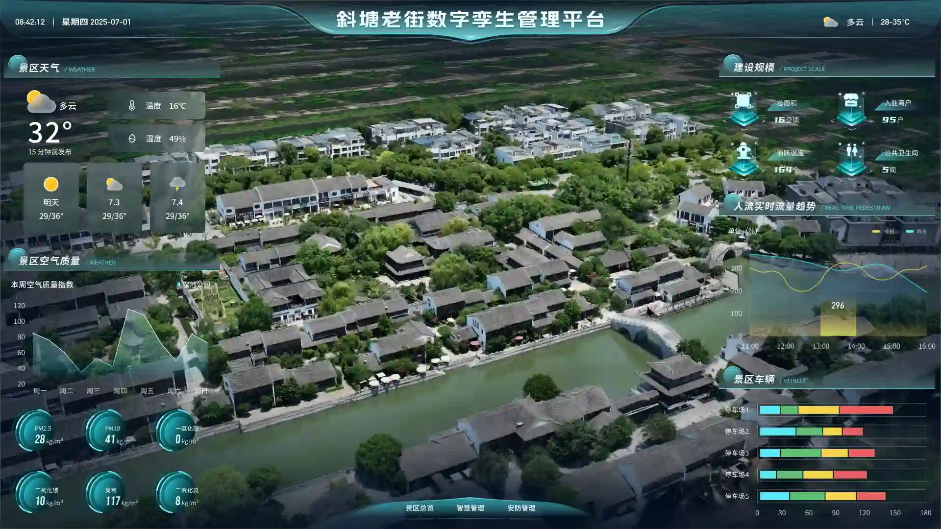
Tourism District Operations Dashboard
Uses high-fidelity 3DGS models with visitor, vehicle, and energy data to support operations, safety, and visitor services.
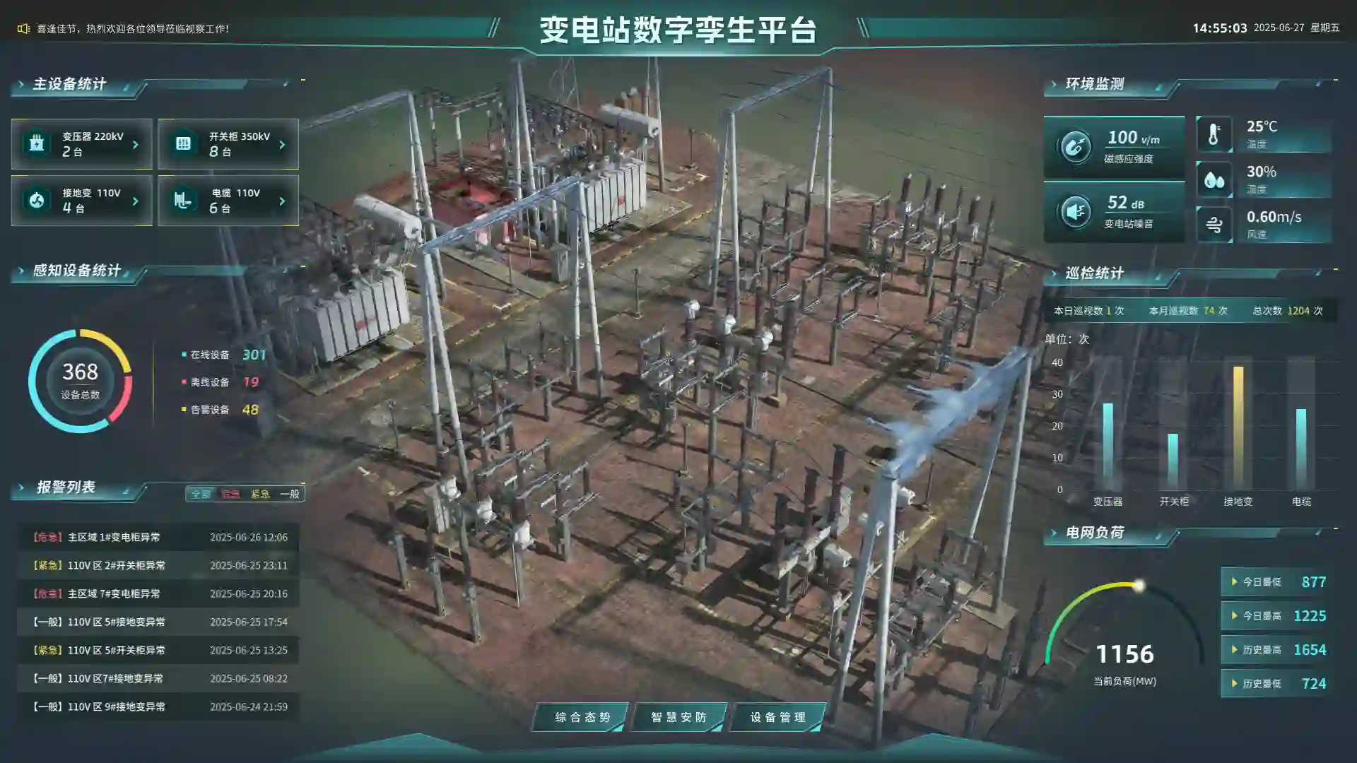
Substation 3D O&M Platform
Uses high-fidelity 3DGS models to monitor equipment status, environment, inspection alerts, and load trends, improving substation operations and risk response.
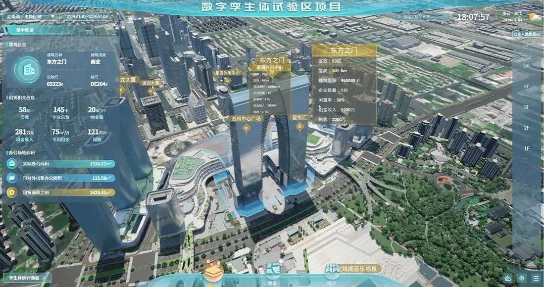
City-Level CIM Platform
Visualizes city-wide buildings in 3D and integrates GIS data for accurate spatial analysis and presentation.
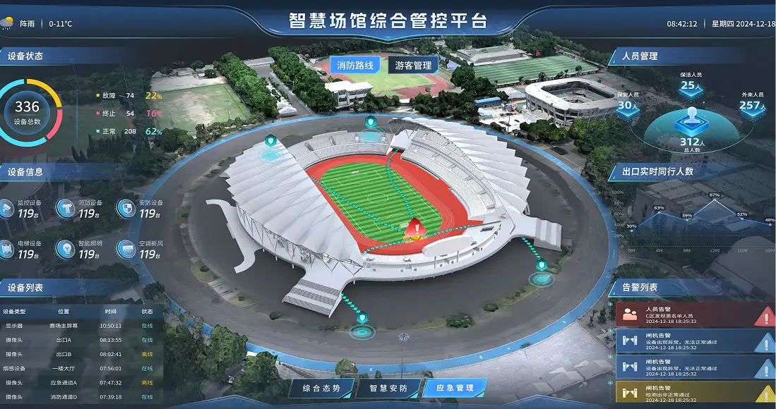
Large-Scale Venue Security Platform
Real-time personnel tracking, intelligent police dispatch, and real-time 3D scene rendering.
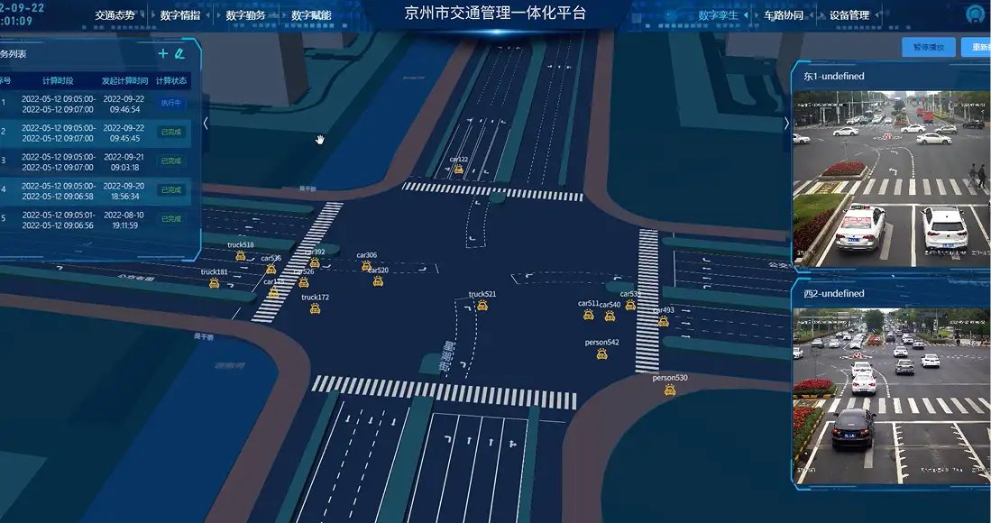
Real-Time Traffic Visualization System
Uses high-precision BeiDou positioning to visualize live traffic flow in 3D, supporting traffic management and emergency response.
Submit Your Requirements, Get Product/Solution Recommendations

 苏公网安备32059002007508号