Data Processing
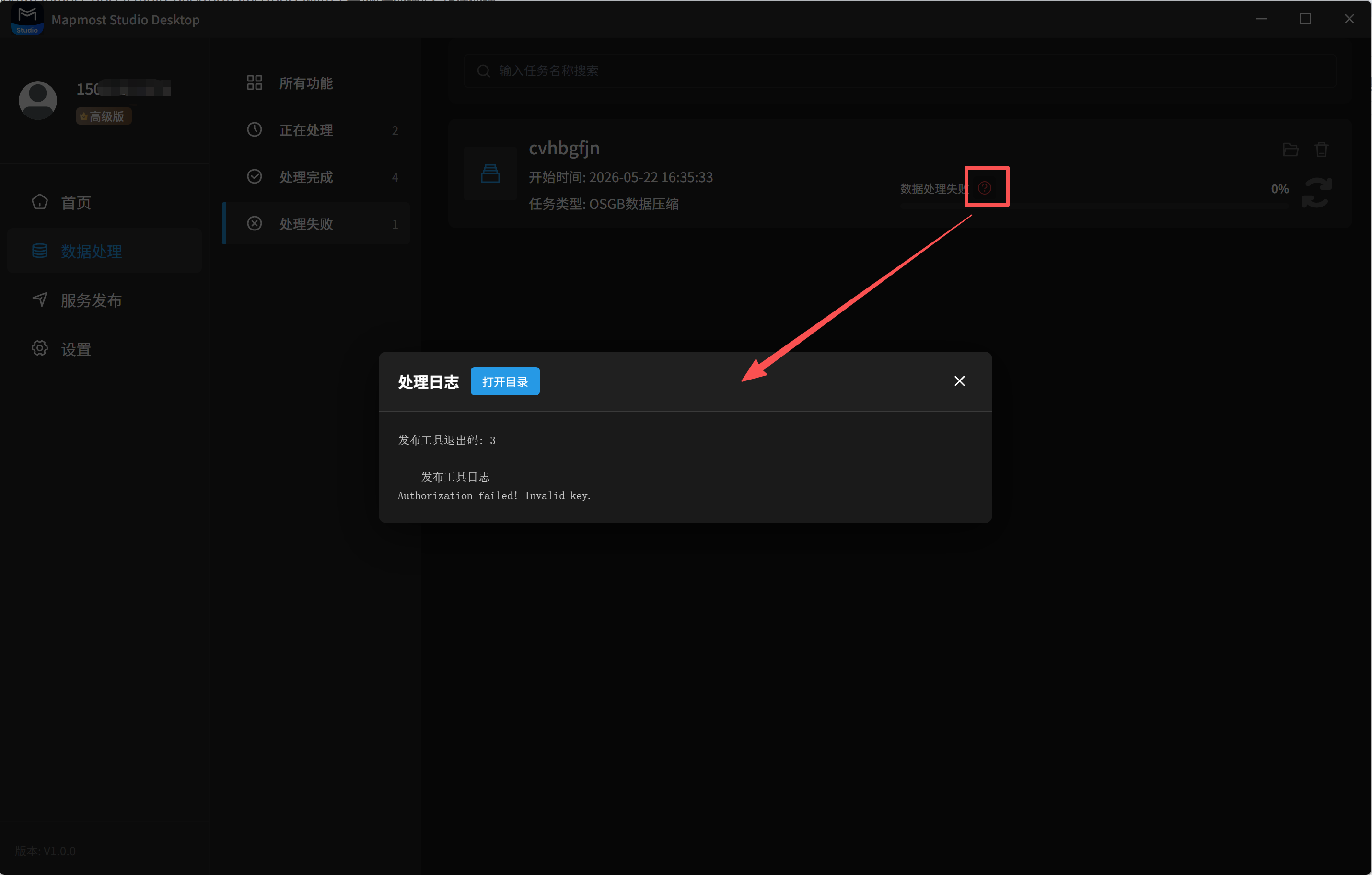
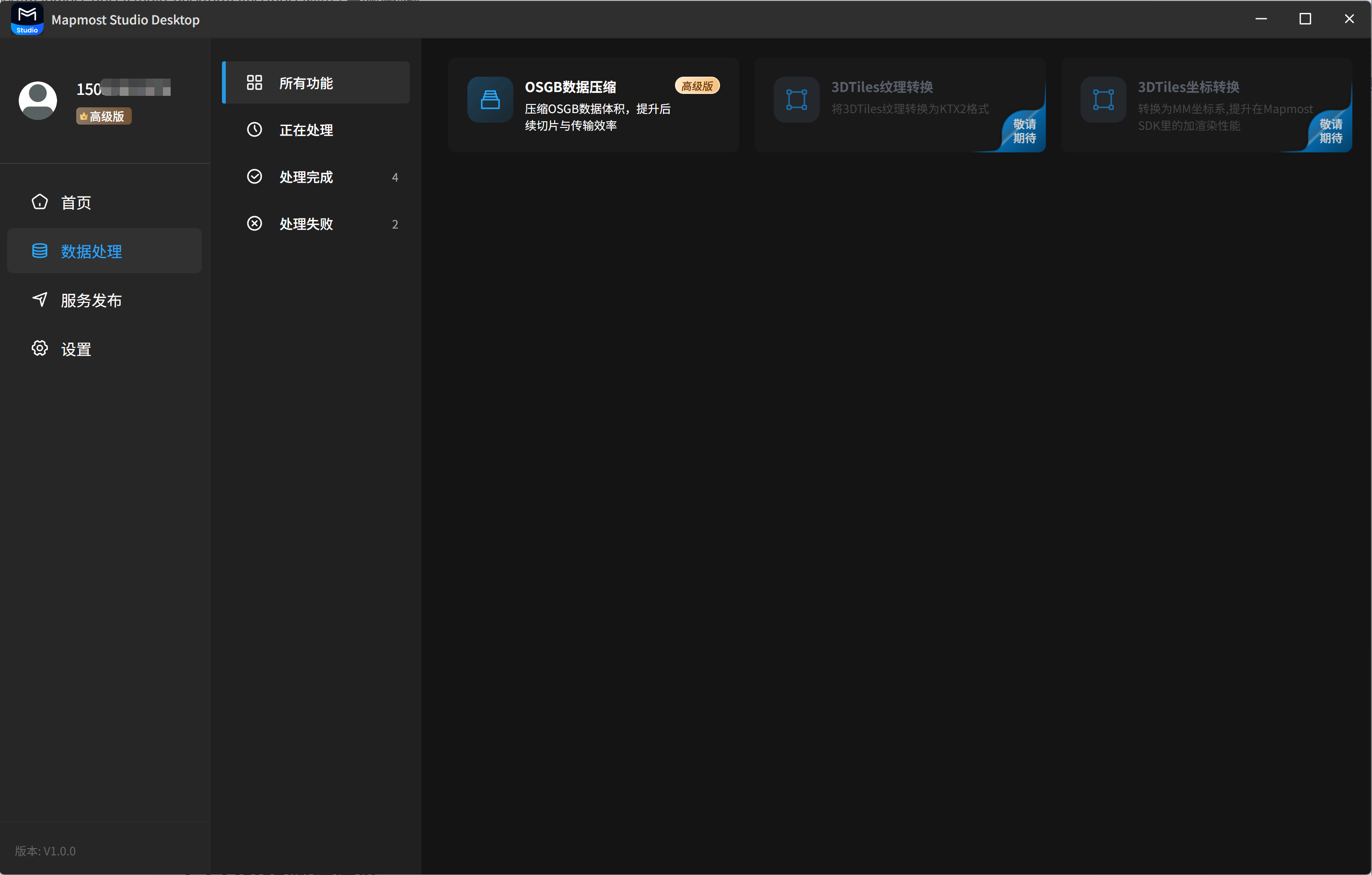
The data processing module provides compression, coordinate conversion, texture conversion, and related capabilities for 2D and 3D data. Core features include OSGB data compression, 3DGS data conversion, 3D Tiles texture conversion (coming soon), and 3D Tiles coordinate conversion (coming soon).
- For detailed OSGB data compression steps, see OSGB Data Compression.
- For detailed 3DGS data conversion steps, see 3DGS Data Conversion.
- For 3D Tiles texture conversion (coming soon), see 3D Tiles Texture Conversion.
- For 3D Tiles coordinate conversion (coming soon), see 3D Tiles Coordinate Conversion.
1. All Features
1.1 OSGB Data Compression
Select a local OSGB file for compression. After compression, the data size of the oblique photography model is greatly reduced, improving subsequent model tiling and transfer efficiency. This is an Advanced feature. It is available as a free 7-day trial. To continue using it after the trial, contact customer service.
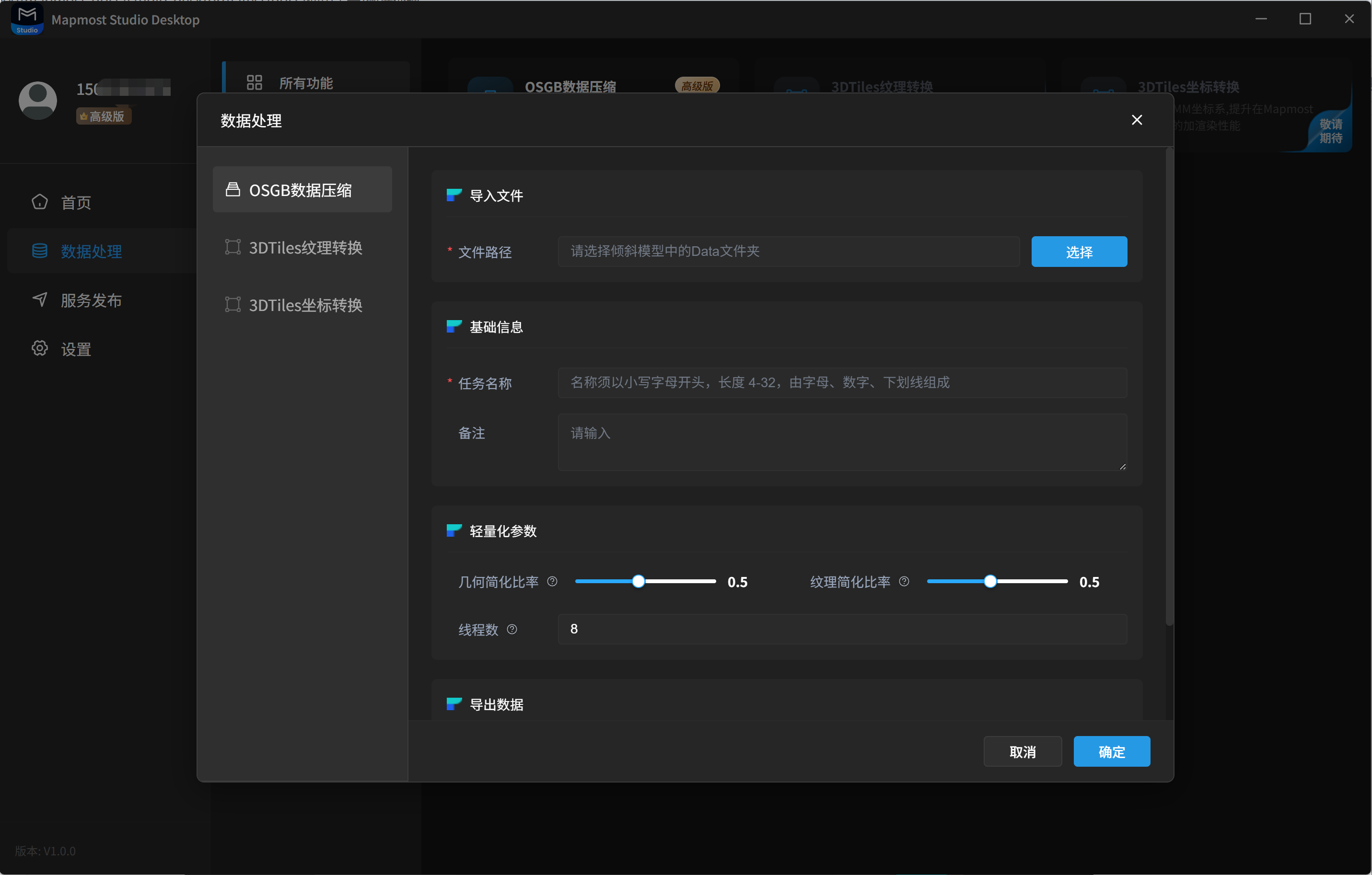
The fields for OSGB data compression are described below:
| Field | Description |
|---|---|
| Import File | Required. Select the local OSGB file to compress. Select the directory that contains the Data folder. |
| Task Name | Required. The name must start with a lowercase letter, contain 4 to 32 characters, and use only letters, numbers, and underscores. |
| Remarks | Optional. Enter notes according to your needs. |
| Geometry Simplification Ratio | Optional. A value between 0.3 and 0.6 is recommended. This greatly reduces the number of faces while preserving the model outline and structural features. |
| Texture Simplification Ratio | Optional. A value between 0.5 and 0.8 is recommended. This reduces texture size and video memory usage while maintaining visual clarity and realism. |
| Thread Count | Optional. Usually set this according to the number of physical CPU cores. This can fully use computing resources while avoiding excessive memory usage or system lag. |
| Output Path | Required. Specify where to save the compressed OSGB file. |
1.2 3DGS Data Conversion
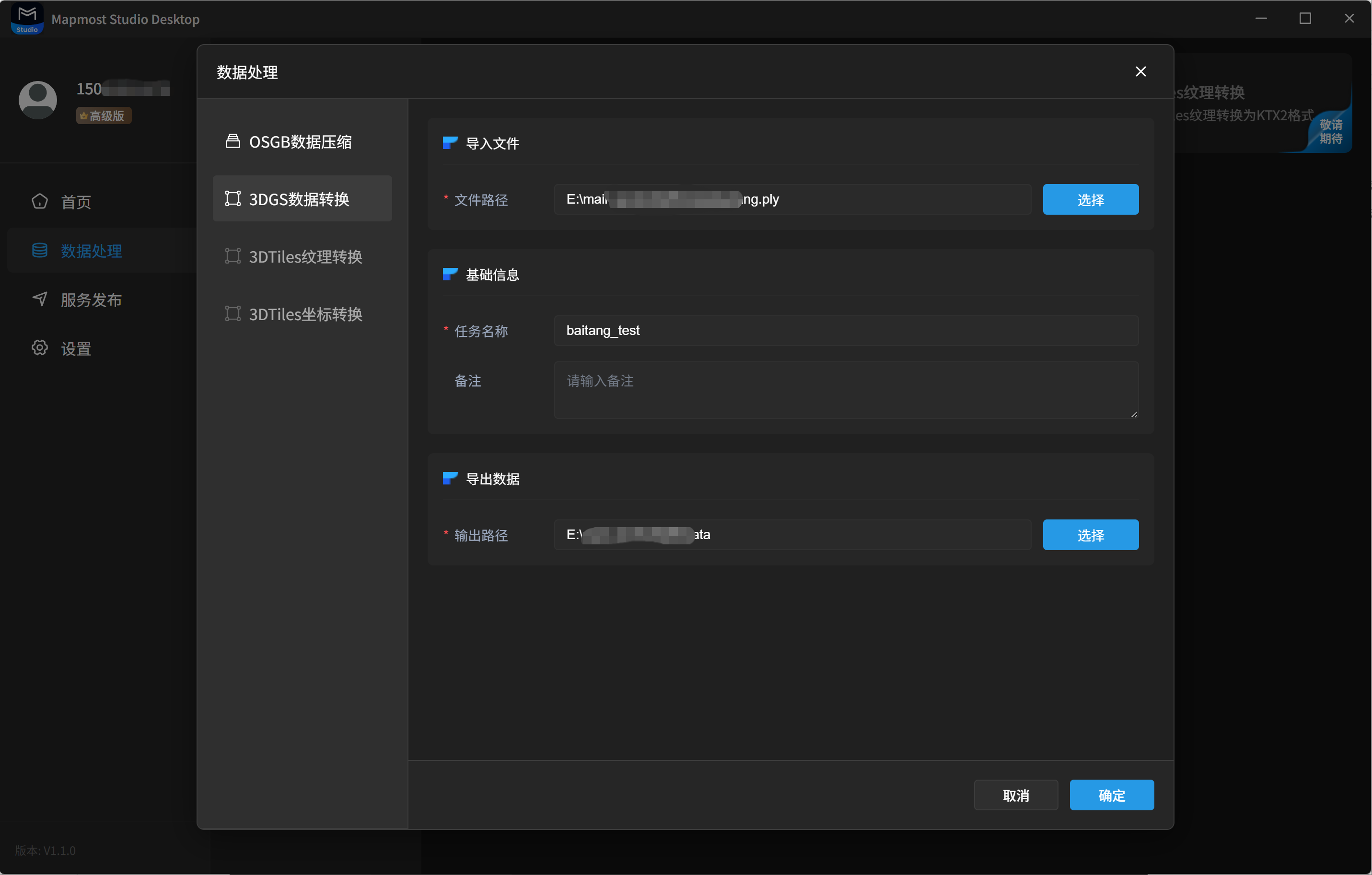
Select a local .ply or .splat 3DGS model, set the output path, and convert it to a .sog 3DGS model.
1.3 3D Tiles Texture Conversion (Coming soon)
This feature converts 3D Tiles texture images from formats such as jpg and png to ktx2 to improve rendering efficiency and performance. It is planned for a future release.
1.4 3D Tiles Coordinate Conversion (Coming soon)
This feature converts 3D Tiles coordinates from EPSG:4978 to the Mapmost coordinate system to improve rendering performance in Mapmost SDK for WebGL. It is planned for a future release.
2. Processing
2.1 View Task Details
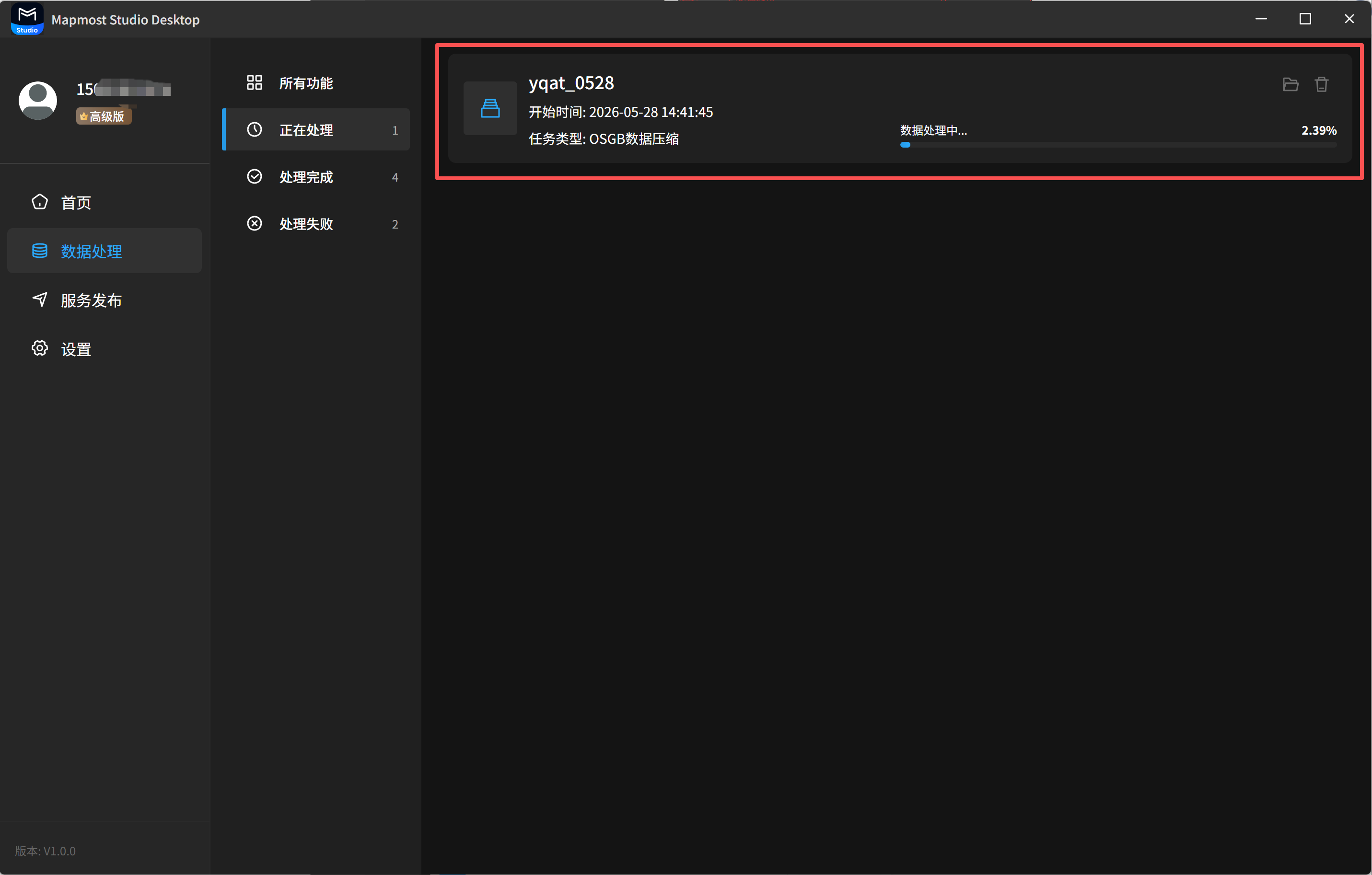
The Processing list displays tasks that are currently running. You can view the task name, start time, progress, and related information.
2.2 View Result Files
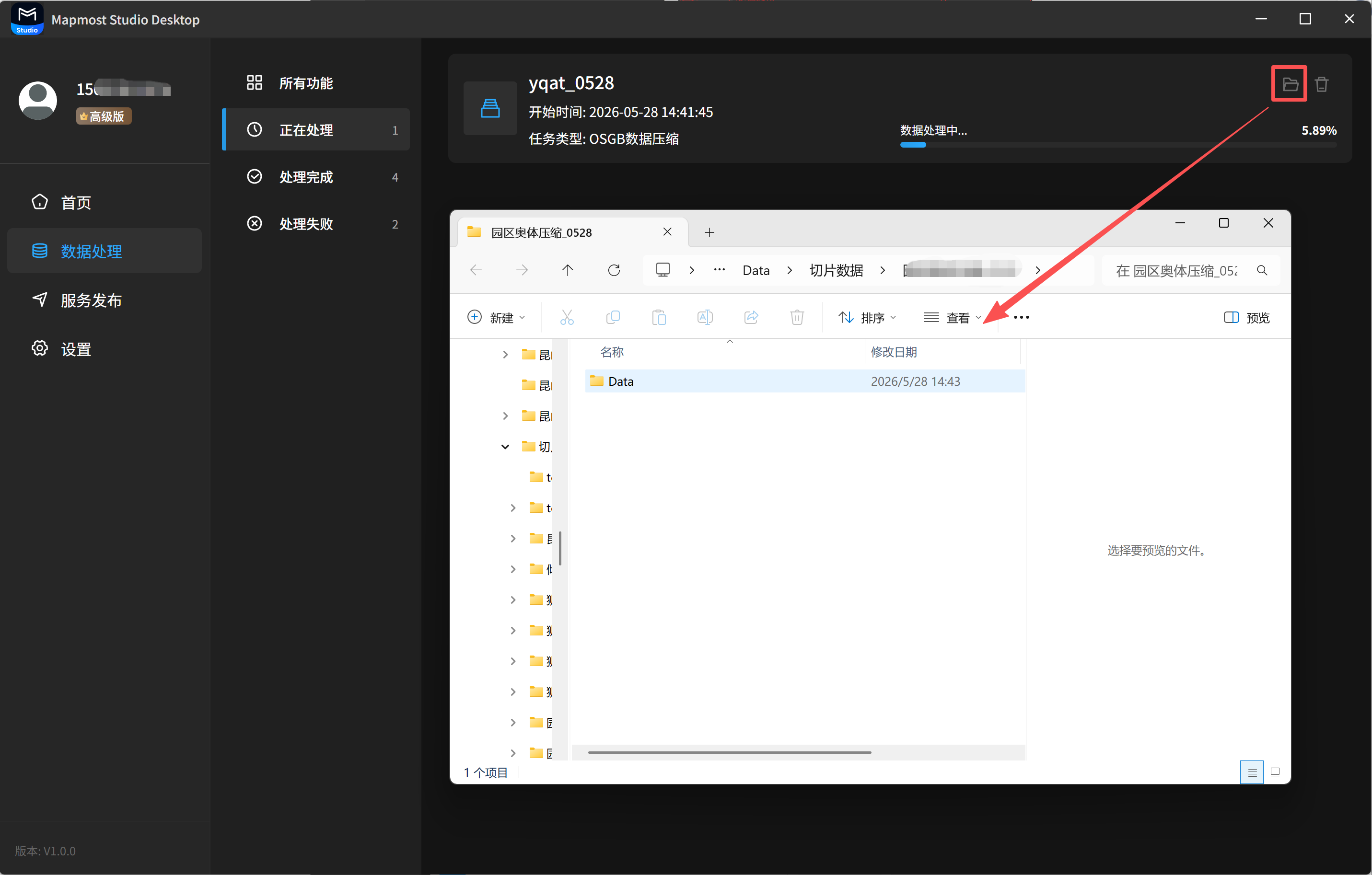
Click the folder button in the upper-right corner of a task card to view result files.
2.3 Delete a Processing Task
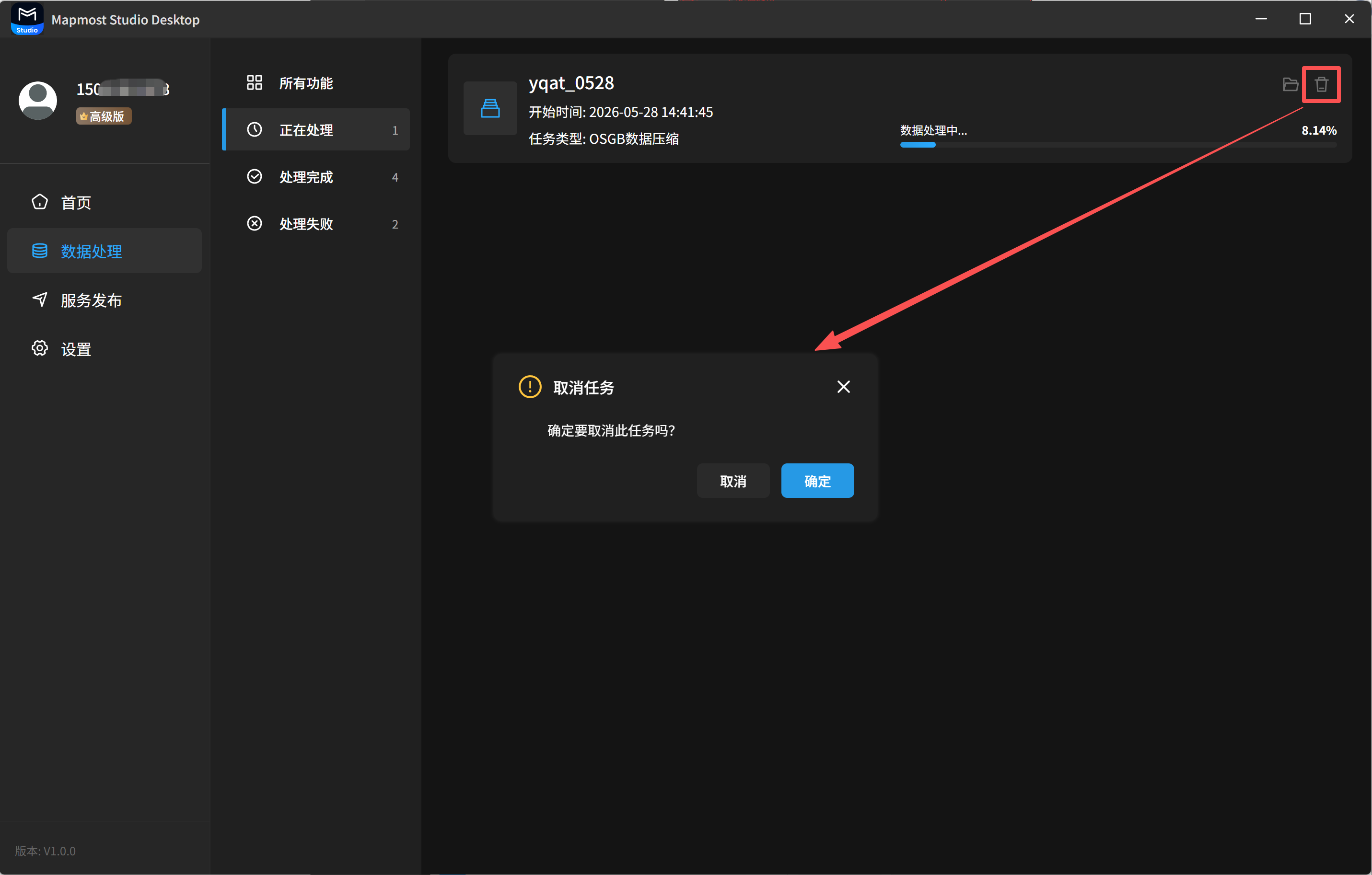
Click the delete button in the upper-right corner of a task card to delete a processing task.
3. Completed
3.1 View Task Details
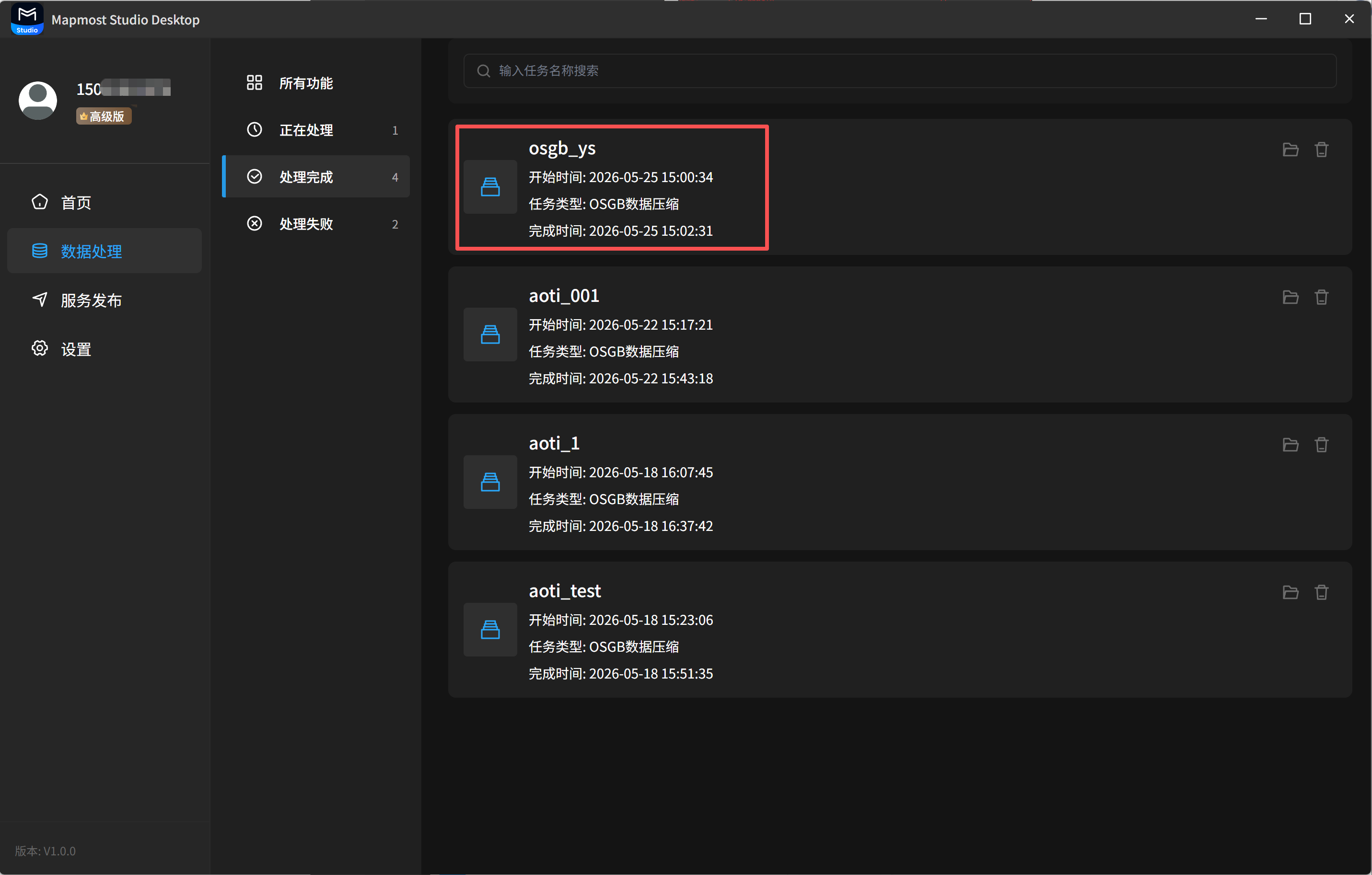
The Completed list displays completed tasks. You can view the task name, task type, start time, completion time, and related information.
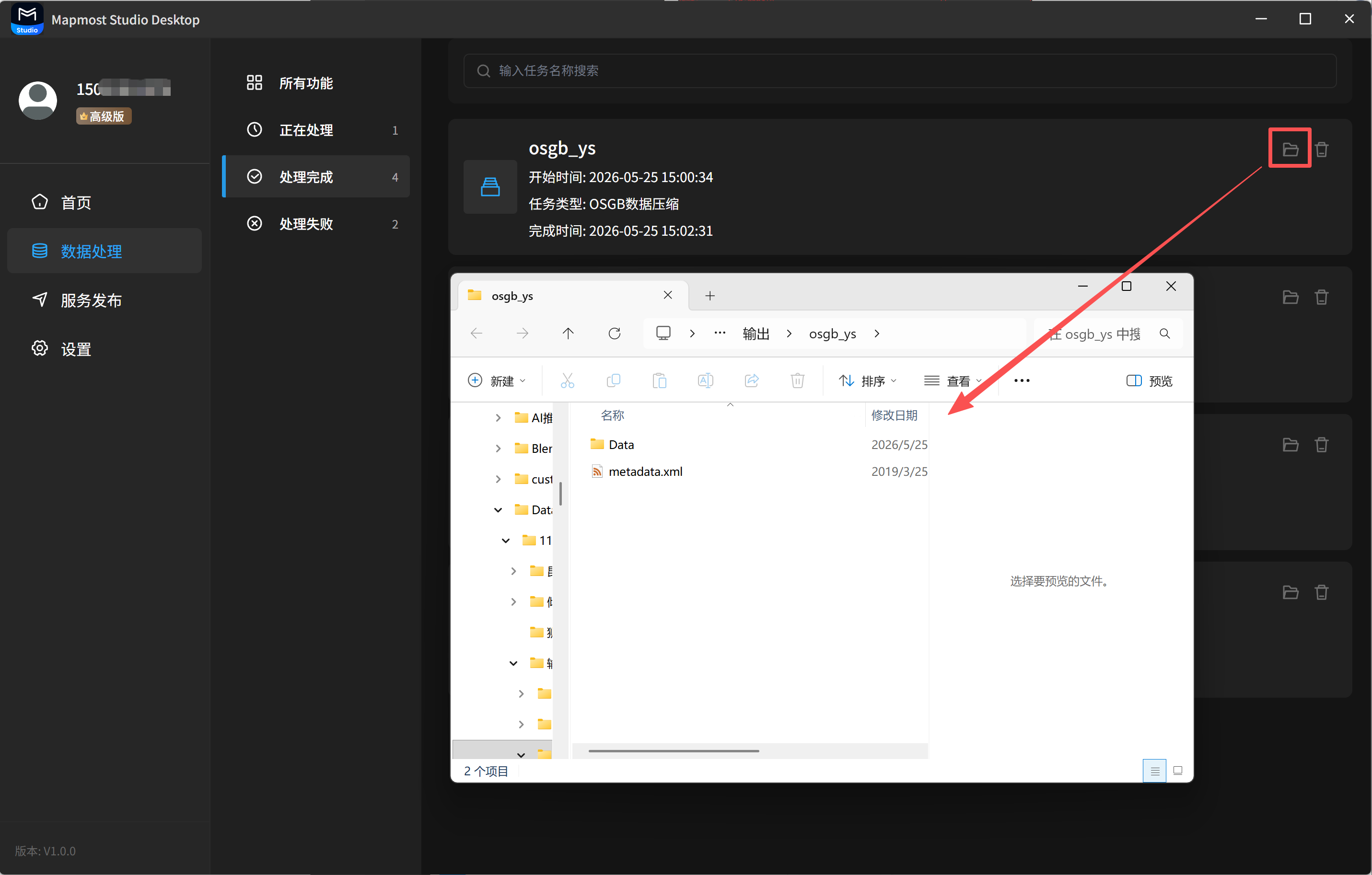
3.2 View Result Files
Click the folder button in the upper-right corner of a task card to view result files.
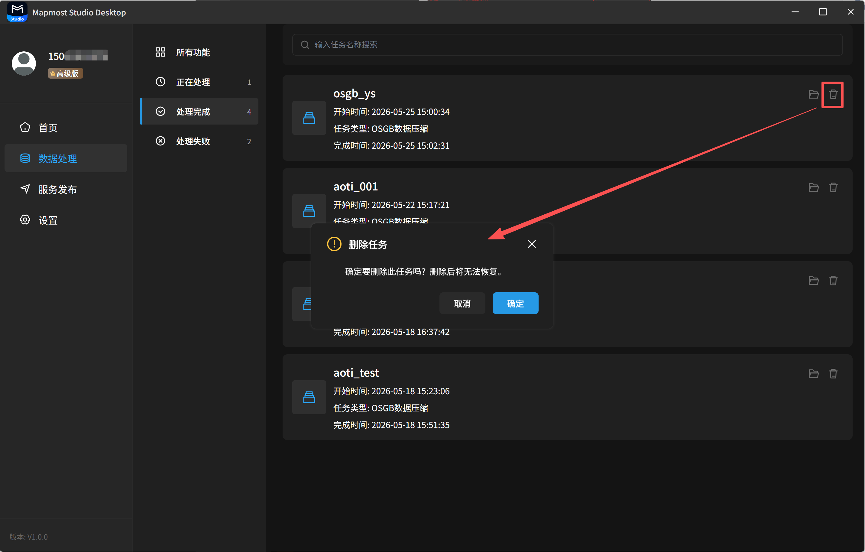
3.3 Delete a Completed Task
Click the delete button in the upper-right corner of a task card to delete a completed task. After deletion, the task and result files cannot be restored.
4. Failed
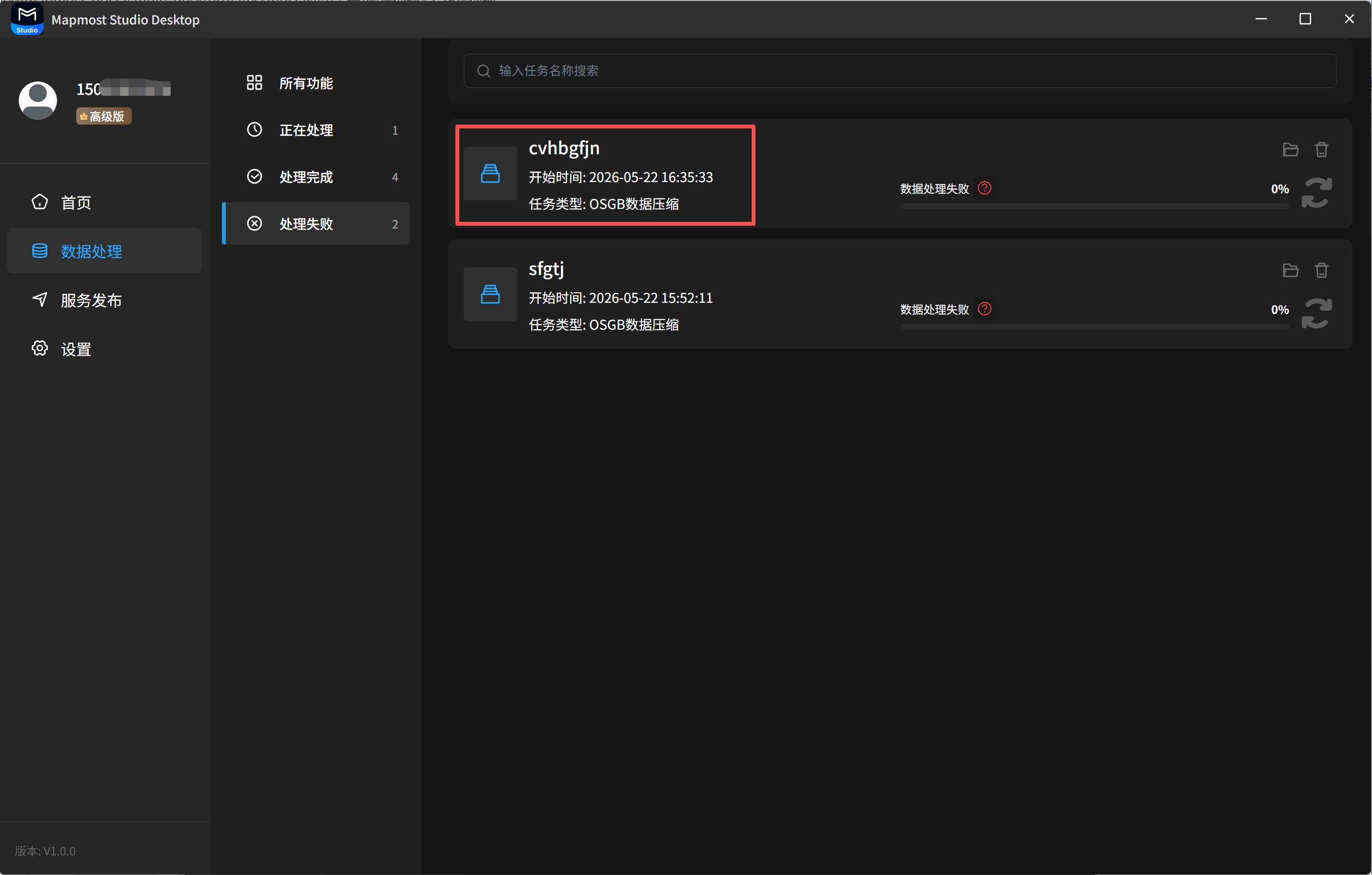
4.1 View Task Details
The Failed list displays failed tasks. You can view the task name, task type, start time, and related information.
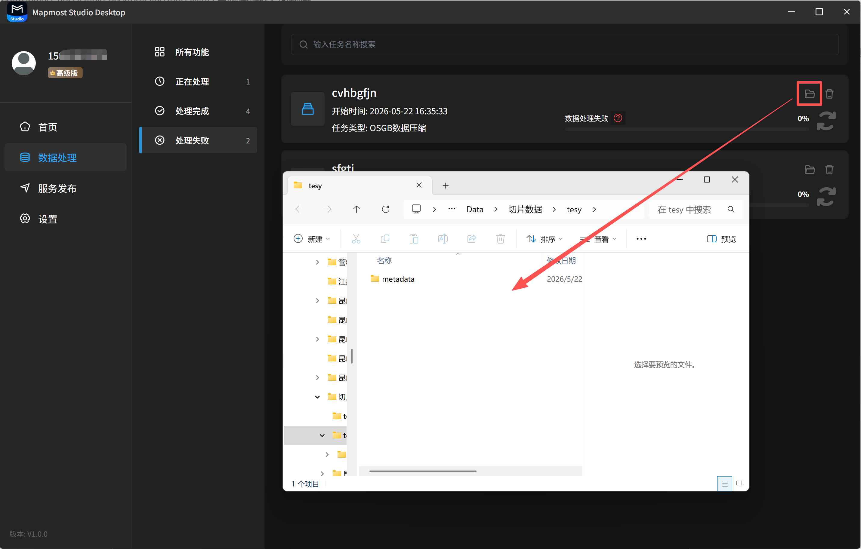
4.2 View Result Files
Click the folder button in the upper-right corner of a task card to view result files.
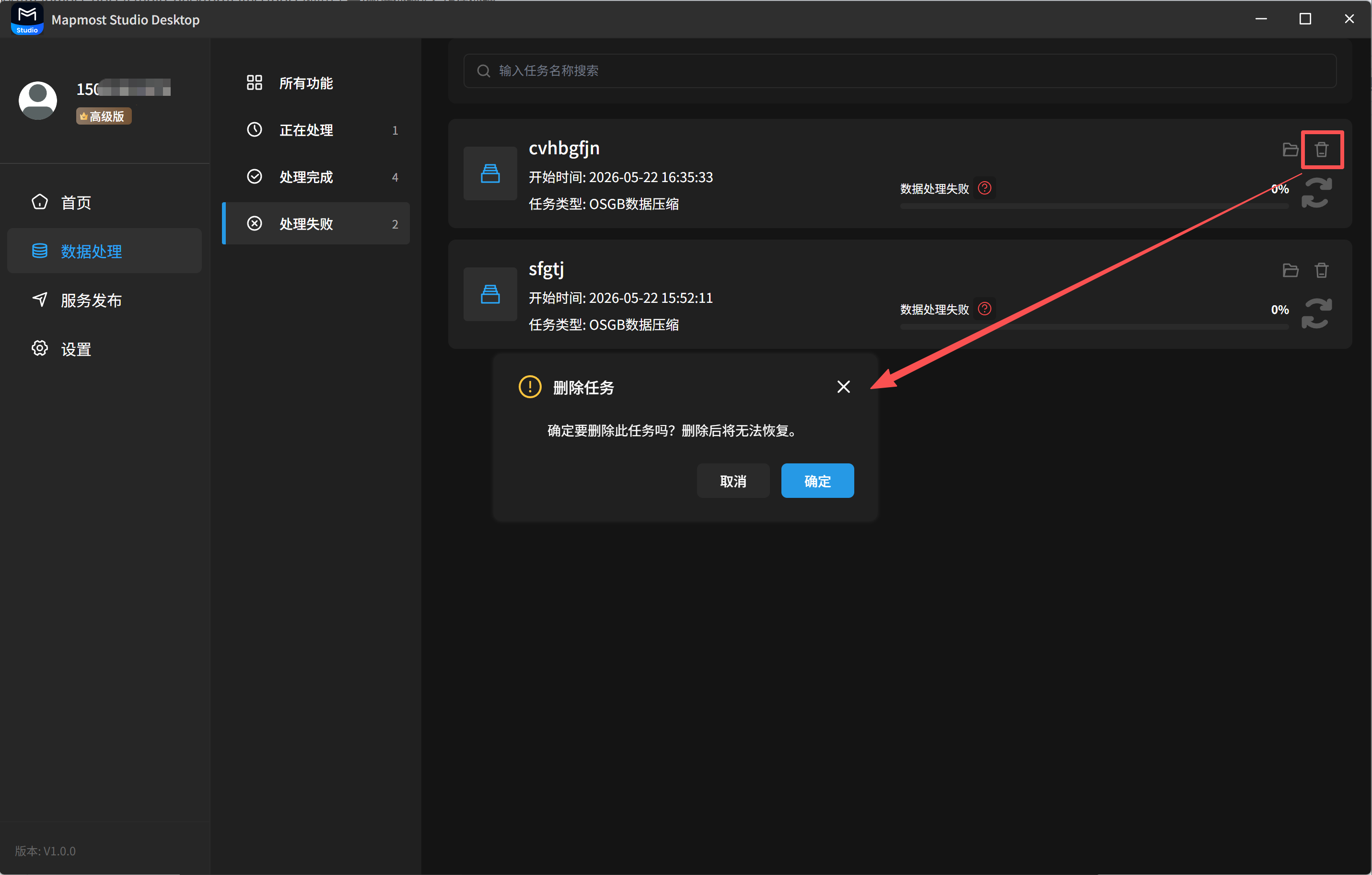
4.3 Delete a Failed Task
Click the delete button in the upper-right corner of a task card to delete a failed task.
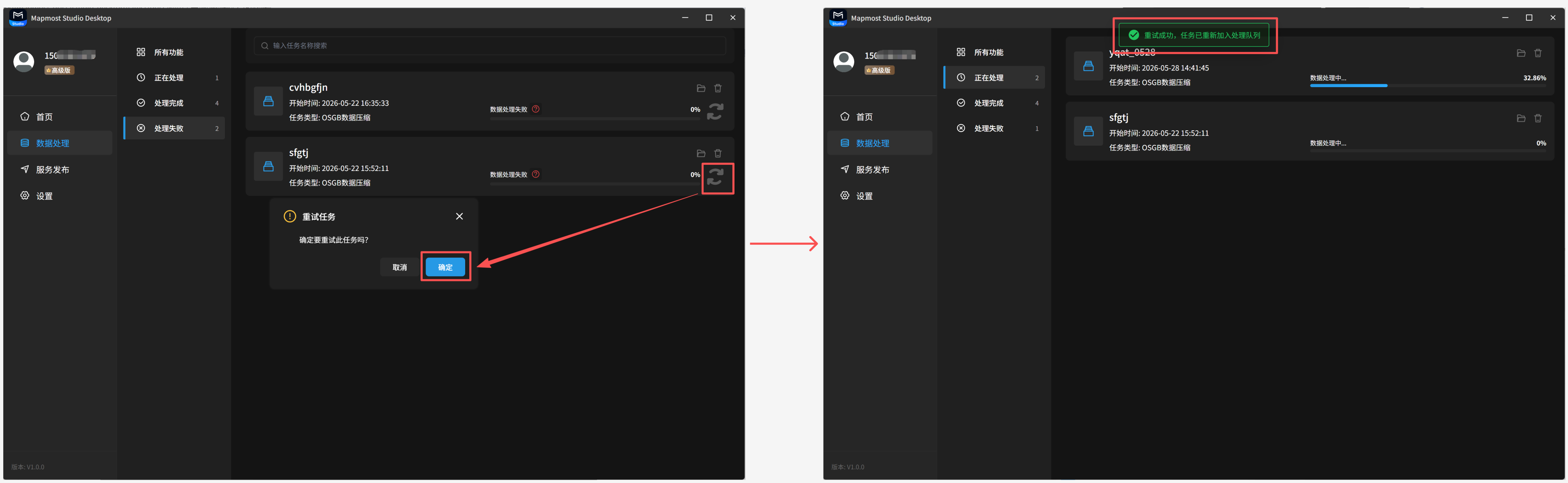
4.4 Process Again
Failed tasks can be processed again.
4.5 View Logs
Failed tasks support log viewing.