Hillshade layer Hillshade configuration
- Hillshade layer data is used to load elevation maps. For details, please refer to "Background layer Background:1.2";
- Add the data source. If the data source already exists, ignore this step. For details, refer to "Cartography Prerequisite: 2";
- The "∑" button behind the parameter value can realize numerical changes at different levels. For details, please refer to "Icon Point Layer Symbol: 3.3.2";
- The "fx" button behind the parameter value can convert the parameter information into an expression. For details, please refer to "Icon Point Layer Symbol: 3.3.3";
1. "Layer Properties" module
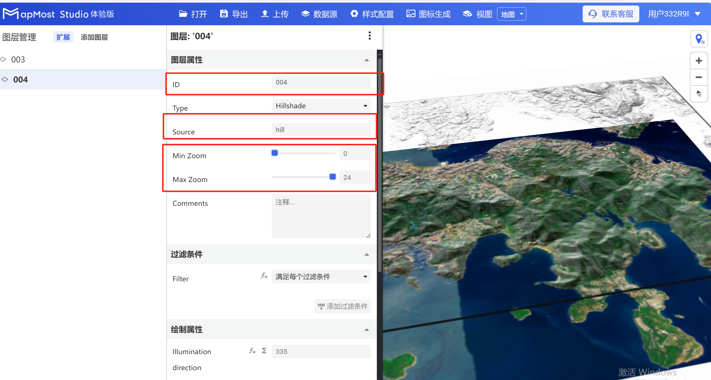
The "Layer Properties" module is used to adjust the layer data source, data type, display level, etc. For details, please refer to "Background layer Background: 1";
1.1 Set layer type
- Change "Type" to "Hillshade", change "Source Layer", set "Min Zoom" and "Max Zoom";
2. "Filter conditions" module
"Filter conditions" module, keep the default;
3. "Drawing Properties" module
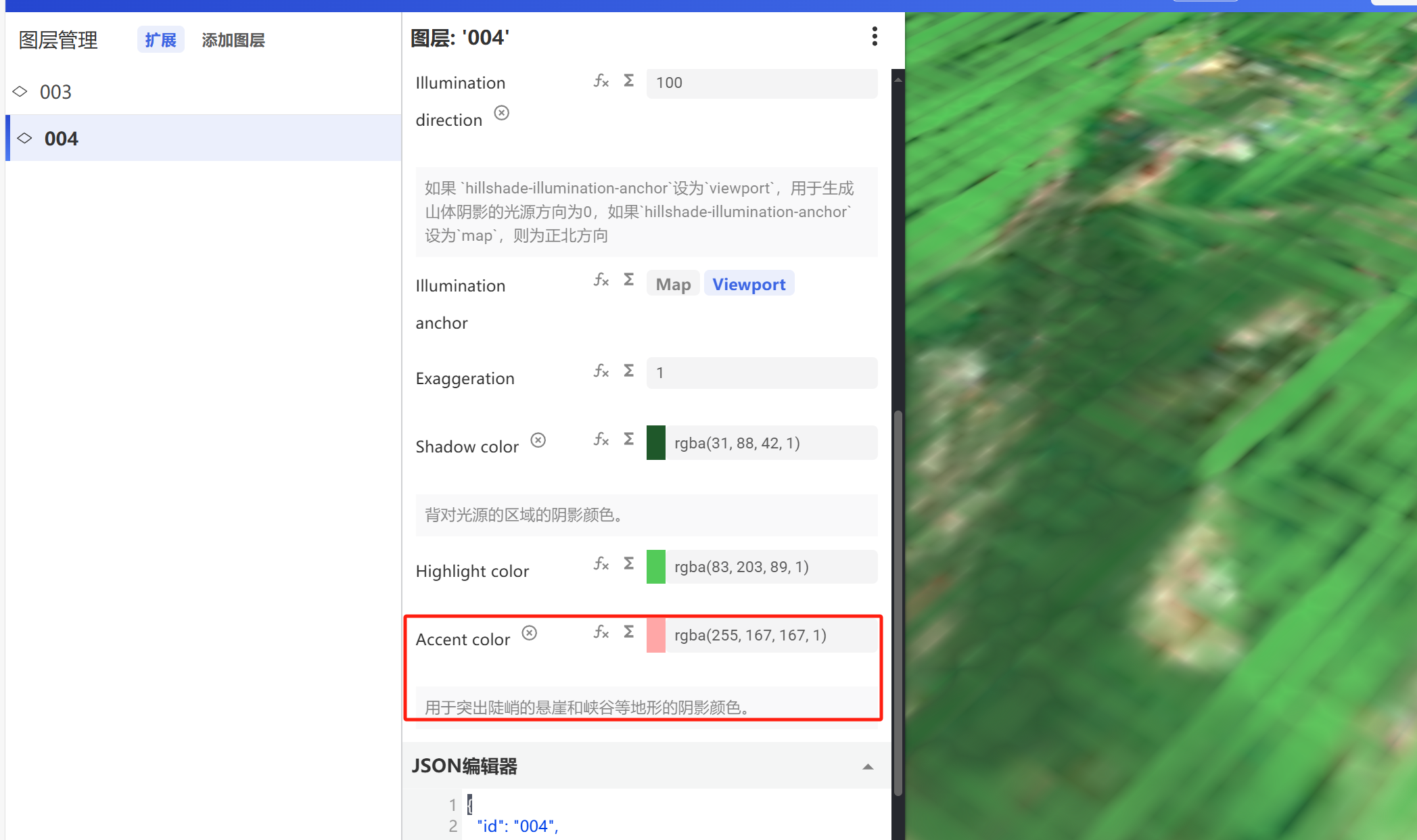
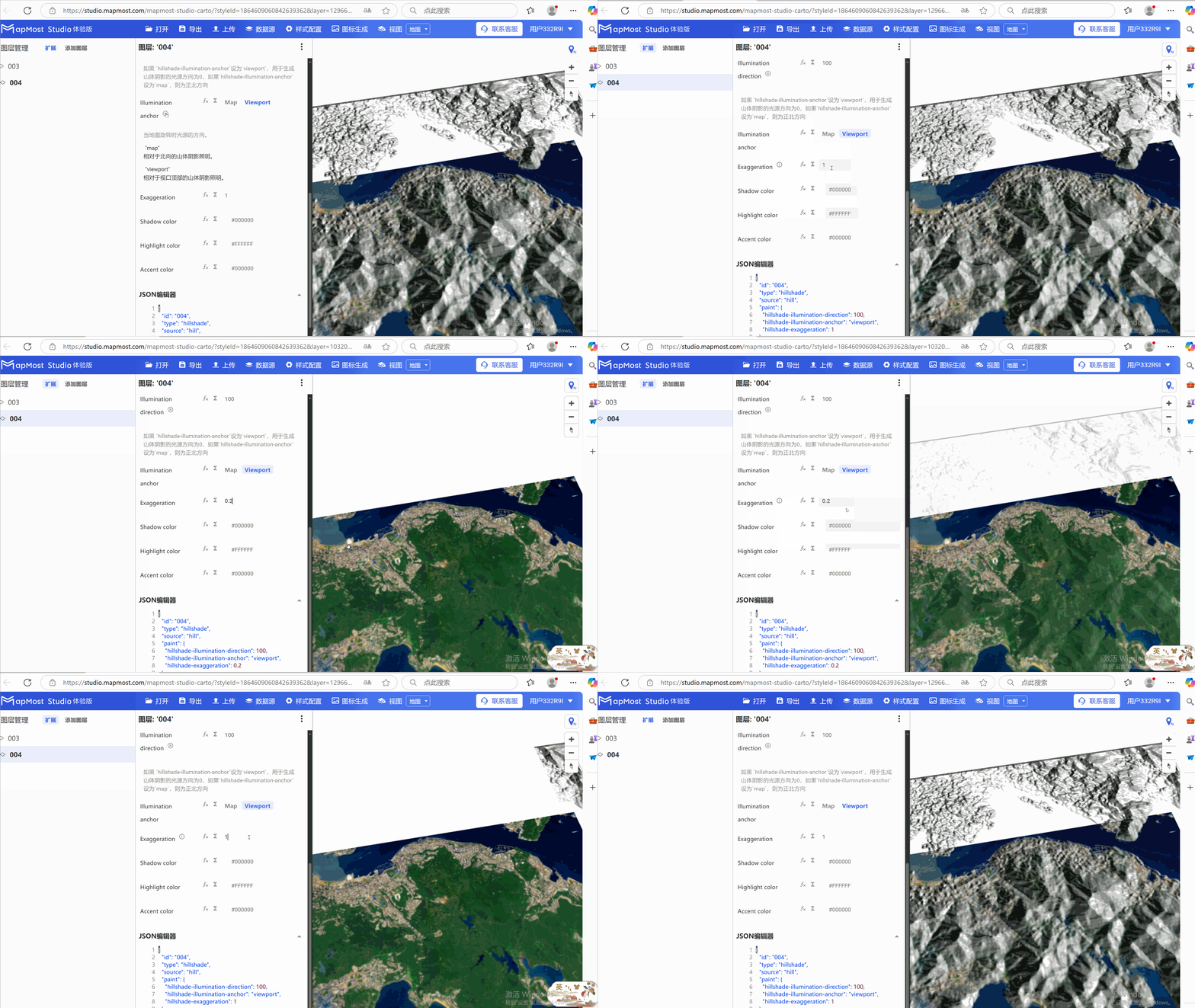
The "Drawing Properties" module is used to set parameters such as the mountain's light direction, mountain shadow intensity, mountain color, and shadow color;
3.1 "Illumination" parameter setting
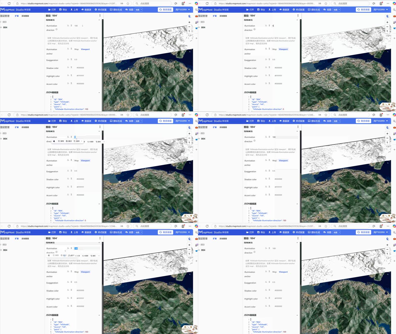
- "Illumination" parameter, set the direction of the light source;
3.2 "Illumination anchor" parameter setting
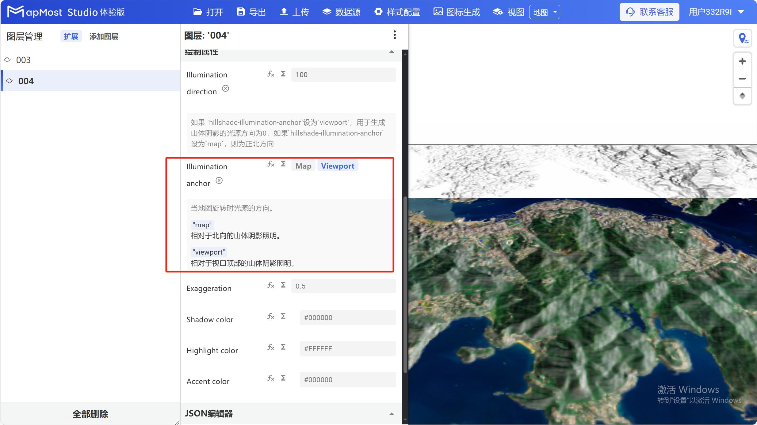
- The "Illumination anchor" parameter sets the light source rotation method, whether it rotates with the map or with the perspective;
3.3 "Exaggeration" parameter setting
- "Exaggeration" parameter, sets the hill shadow intensity;
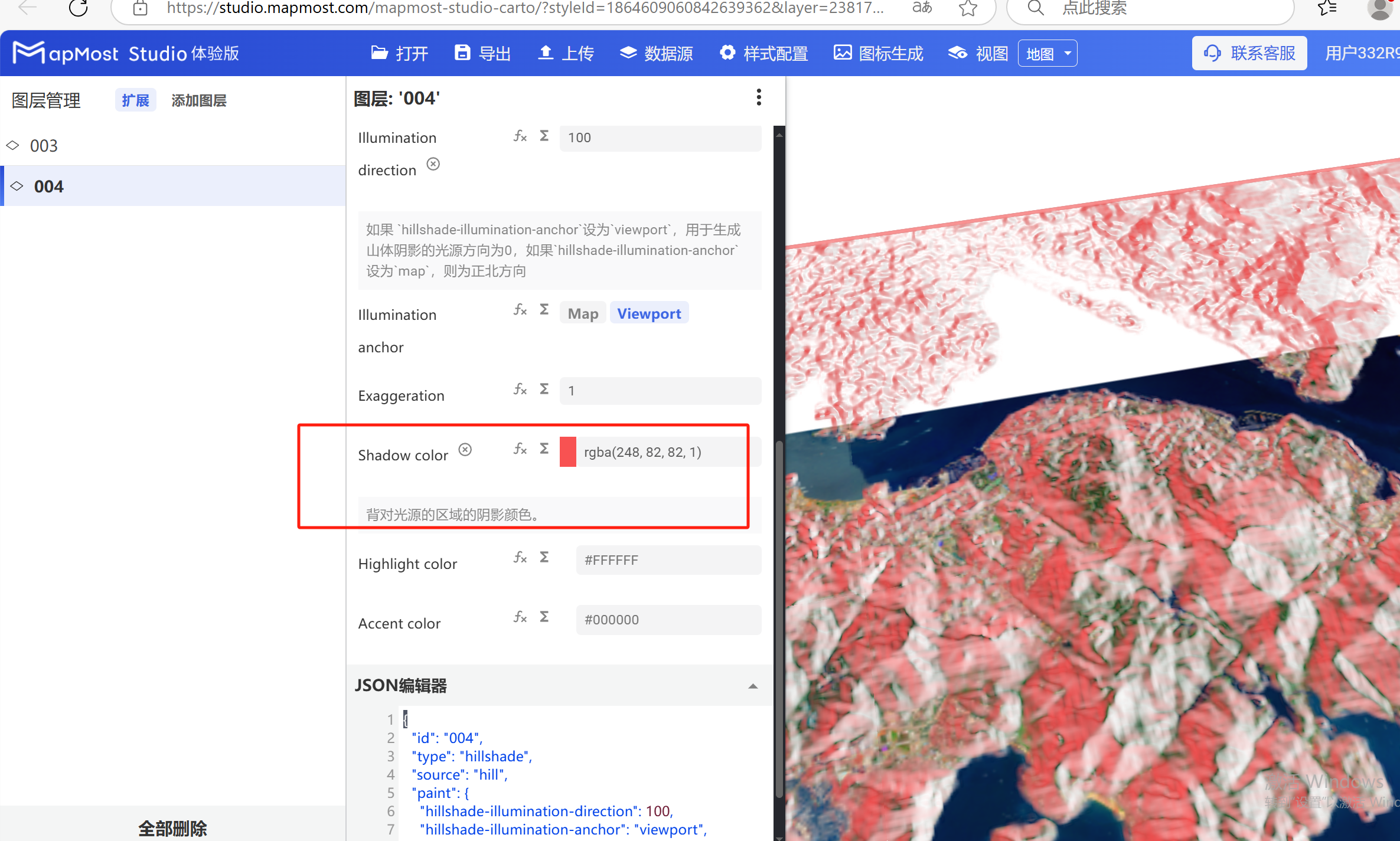
3.4 "Shadow color" parameter setting
- "Shadow color" parameter, sets the color of the mountain shadow;
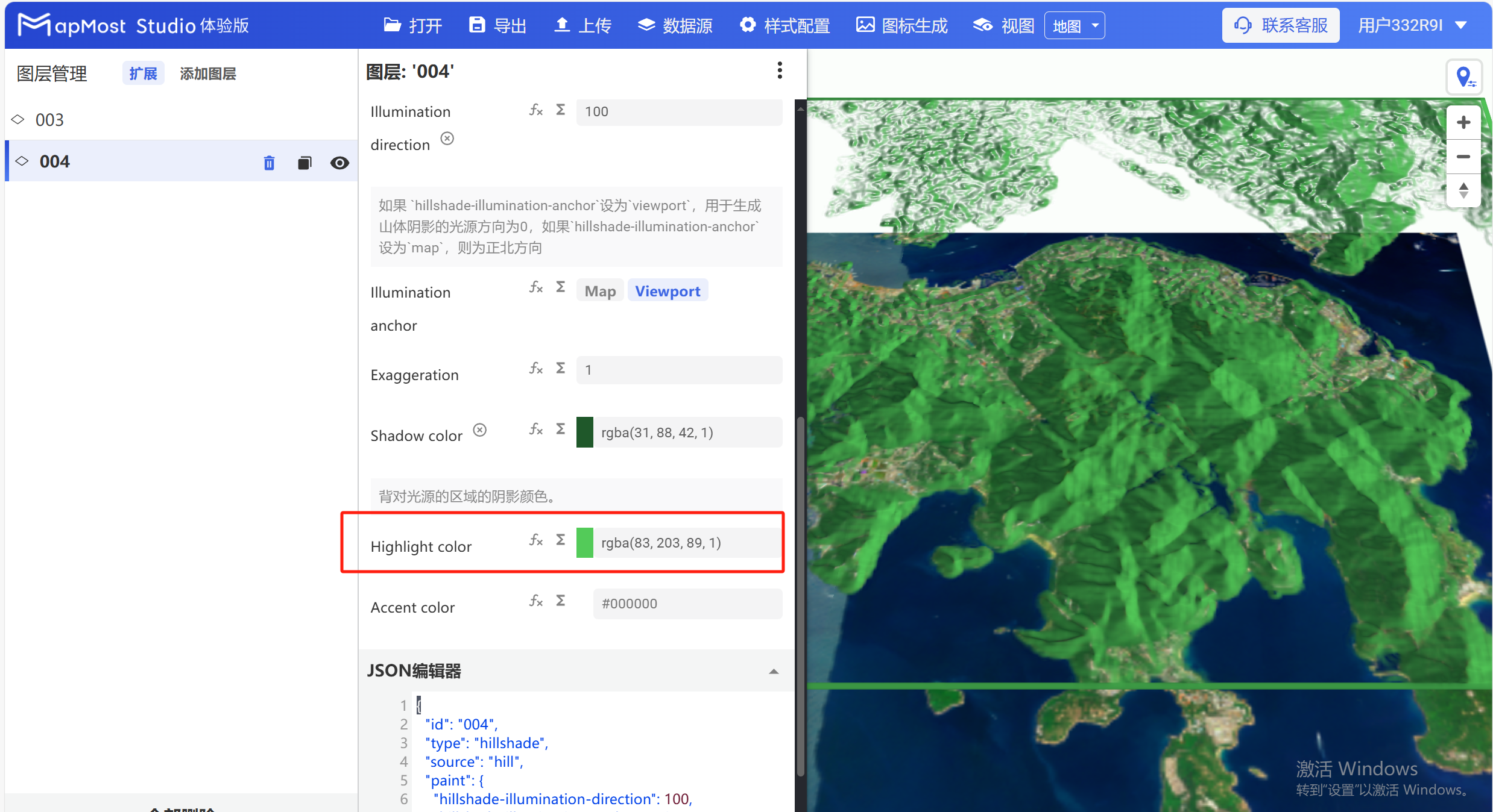
3.5 "Highlight color" parameter setting
- "Highlight color" parameter, sets the color of the light-receiving surface of the mountain;
3.6 "Accent color" parameter setting
- The "Accent color" parameter sets the color of mountain cliffs and shadows;